Vancouver Island stands as one of North America’s premier outdoor adventure destinations, offering an extraordinary diversity of landscapes within its 31,285 square kilometres. From the temperate rainforests of the Pacific Coast to the alpine peaks of Strathcona Provincial Park, this rugged wilderness sanctuary provides unparalleled opportunities for outdoor enthusiasts seeking authentic wilderness experiences. The island’s unique position in the Pacific Northwest creates a convergence of marine and terrestrial ecosystems that supports over 220 bird species, five salmon varieties, and iconic megafauna including orcas, grizzly bears, and black bears.
What sets Vancouver Island apart from other outdoor destinations is its remarkable accessibility combined with genuine wilderness character. Adventure seekers can transition from world-class surfing beaches to alpine climbing routes within a single day, whilst the island’s extensive trail networks accommodate everyone from casual day hikers to experienced backcountry explorers. The temperate coastal climate ensures year-round outdoor activity opportunities, with mild winters that rarely see snow at sea level and comfortable summers ideal for multi-day expeditions.
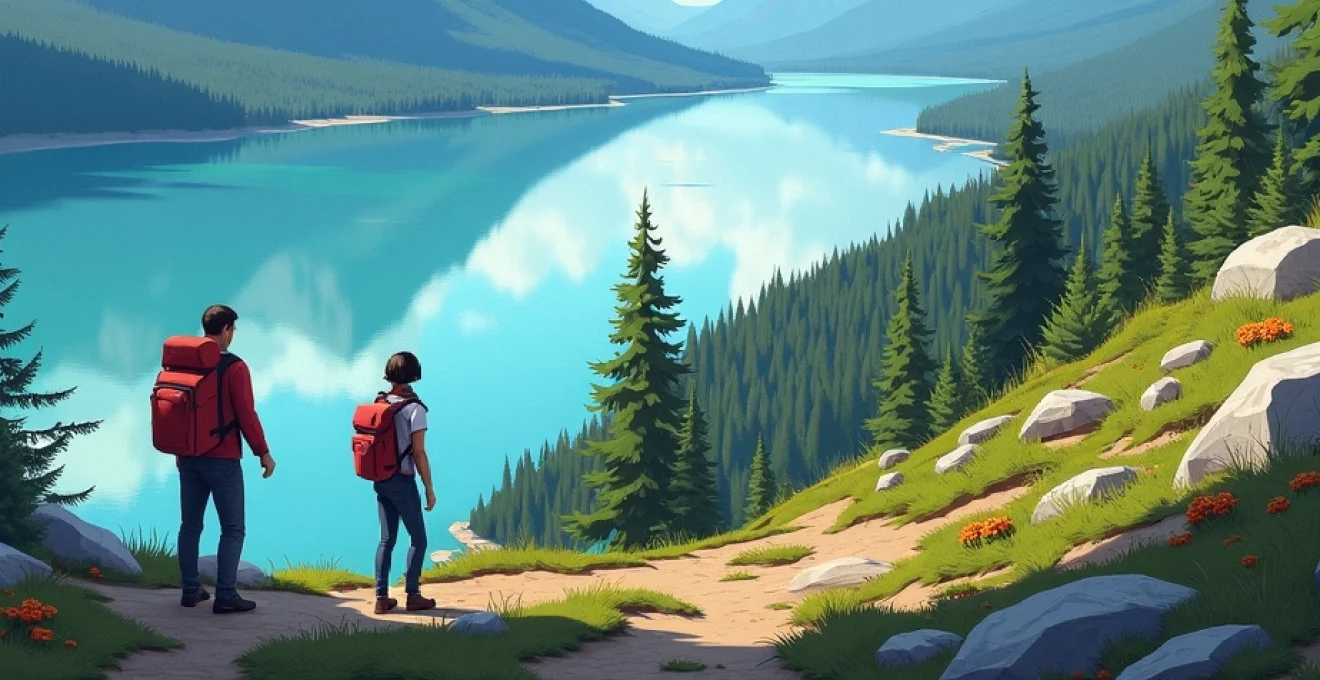
Wilderness hiking networks across vancouver island’s diverse ecosystems
Vancouver Island’s hiking infrastructure represents one of Canada’s most sophisticated trail systems, encompassing over 1,000 kilometres of maintained pathways through diverse ecological zones. The island’s topography creates distinct hiking experiences, from coastal ridge walks offering panoramic ocean vistas to interior forest trails winding through ancient Douglas fir groves. Trail difficulty ranges from gentle nature walks suitable for families to challenging multi-day expeditions requiring advanced wilderness skills and technical equipment.
The provincial park system maintains detailed trail classifications using a standardised difficulty rating system that considers elevation gain, technical challenges, and route-finding requirements. Experienced hikers will appreciate the comprehensive trail maintenance standards, with wooden boardwalks protecting sensitive bog ecosystems and strategically placed bridges spanning seasonal creek crossings. Many trails feature interpretive signage explaining indigenous cultural history and ecological significance of specific locations.
West coast trail’s 75-kilometre backcountry challenge through pacific rim national park
The West Coast Trail stands as Vancouver Island’s most demanding hiking experience, requiring 5-7 days to complete its full 75-kilometre length between Bamfield and Renfrew. This historic trail follows traditional indigenous travel routes and former telegraph lines, incorporating challenging terrain including tidal pools, suspension bridges, and technical beach sections requiring tide-table navigation. The trail’s rugged character demands advanced preparation, with mandatory pre-trip orientation sessions and reservation systems limiting access to preserve environmental integrity.
Hikers encounter diverse coastal ecosystems including temperate rainforest, rocky shoreline, and expansive sandy beaches. The trail features approximately 140 numbered waypoints and requires rope-assisted descents, ladder climbing, and stream crossings. Wilderness camping occurs at designated sites equipped with bear caches and composting toilets, whilst emergency shelters provide refuge during severe weather events. The challenging nature of this route attracts experienced backpackers seeking authentic wilderness immersion.
Juan de fuca marine trail’s coastal ridge navigation systems
The Juan de Fuca Marine Trail offers a more accessible coastal hiking experience, spanning 47 kilometres along Vancouver Island’s southwestern coastline. This trail system connects four distinct trailheads, allowing flexible itinerary planning from single-day excursions to multi-day expeditions. The route showcases dramatic clifftop viewpoints, secluded beaches, and opportunities for marine wildlife observation including grey whales during migration periods.
Trail infrastructure includes well-maintained suspension bridges, wooden staircases navigating steep coastal bluffs, and designated camping areas with water sources. Navigation complexity remains moderate, though coastal weather conditions can create challenging visibility situations requiring compass skills and GPS backup systems. The trail’s proximity to Victoria makes it popular among regional outdoor enthusiasts whilst maintaining authentic wilderness character.
Strathcona provincial park’s alpine route planning through forbidden plateau
Strathcona Provincial Park encompasses Vancouver Island’s highest peaks and most technical alpine terrain, with the Forbidden Plateau area offering premier mountain hiking experiences. The plateau’s unique geography creates subalpine meadow systems surrounded by dramatic volcanic peaks, providing hiking routes ranging from day trips to extended wilderness expeditions. Alpine conditions require specialised equipment and weather awareness, as elevation changes create distinct microclimates.
Route planning considerations include seasonal snow cover lasting into early summer at higher elevations and rapidly changing weather patterns typical of coastal mountain environments. The park’s trail system connects multiple alpine lakes and provides access to technical climbing routes on peaks including Mount Albert Edward and Mount Washington. Backcountry camping opportunities exist throughout the park, though alpine sites require Leave No Trace practices and proper food storage protocols.
North coast trail’s remote wilderness access via cape scott provincial park
Cape Scott Provincial Park’s North Coast Trail represents Vancouver Island’s most remote hiking destination, requiring significant commitment and advanced wilderness skills. The 58-kilometre trail system explores the island’s rugged northwestern tip, featuring pristine beaches, old-growth forest, and historical remnants of early European settlement attempts. This trail attracts serious backcountry enthusiasts seeking solitude and challenging conditions.
Access requires a 90-minute drive on logging roads followed by a 2.5-kilometre hike to reach the main trailhead. The trail traverses diverse terrain including dense rainforest, exposed headlands, and expansive sand beaches. Weather conditions can be severe, with frequent storms and high precipitation levels requiring waterproof equipment and flexible timing. The remote location means self-sufficiency is essential, as emergency assistance may be significantly delayed.
Multi-seasonal water sports infrastructure and marine activity zones
Vancouver Island’s extensive coastline and inland waterways create exceptional opportunities for water-based outdoor activities throughout the year. The island benefits from both Pacific Ocean exposure and protected inland passages, supporting diverse marine environments that cater to different skill levels and interests. Coastal waters maintain relatively stable temperatures due to Pacific currents, whilst inland lakes and rivers provide alternative venues during adverse ocean conditions.
Marine infrastructure includes numerous boat launches, marina facilities, and specialised equipment rental operations concentrated in coastal communities. The island’s position within major migration corridors ensures consistent wildlife viewing opportunities, whilst diverse fish populations support world-class angling experiences. Water sport enthusiasts can transition between activities based on seasonal conditions, weather patterns, and personal preferences.
The convergence of Pacific currents and coastal geography creates some of North America’s most consistent surfing conditions, with waves suitable for all skill levels year-round.
Tofino’s surf break classifications and chesterman beach wave mechanics
Tofino has earned recognition as Canada’s surfing capital, offering consistent wave conditions and comprehensive surf education infrastructure. The town’s location on Clayoquot Sound’s outer coast creates exposure to Pacific swells whilst maintaining protected areas suitable for beginners. Multiple surf breaks accommodate different skill levels, from gentle beach breaks to challenging reef breaks requiring advanced techniques.
Chesterman Beach represents Tofino’s most accessible surfing location, featuring a long sandy bottom that creates forgiving wave conditions ideal for learning. The beach’s orientation captures both winter storm swells and summer wind swells, ensuring year-round surfing opportunities. Water temperatures range from 8°C in winter to 15°C in summer, requiring appropriate wetsuit thickness for comfort and safety. Local surf schools provide equipment rental and instruction services supporting the growing surf tourism industry.
Telegraph cove’s orca whale watching corridors and johnstone strait navigation
Telegraph Cove serves as the primary launching point for orca whale watching expeditions in Johnstone Strait, one of North America’s most reliable locations for killer whale observation. The strait’s narrow configuration and abundant salmon runs create predictable whale movement patterns, with resident orca pods frequenting the area from May through October. Marine tour operators utilise various vessel types, from small zodiac boats to larger passenger vessels.
Johnstone Strait’s geography creates unique acoustic conditions that enhance whale watching experiences, as orca vocalisations echo between the strait’s steep-sided walls. The area supports three distinct orca populations: residents, transients, and offshore populations, each displaying different behavioural patterns. Whale watching protocols follow strict guidelines maintaining appropriate distances and minimising disturbance to marine mammals whilst maximising observation opportunities.
Cowichan river system’s fly fishing techniques for steelhead and chinook salmon
The Cowichan River has achieved legendary status among fly fishing enthusiasts, earning designation as the “Fly Fishing Capital of Canada” due to its exceptional steelhead and salmon populations. The river system’s diverse water types include deep pools, riffle sections, and slow-moving runs that support different angling techniques throughout the season. Native and hatchery fish populations provide year-round fishing opportunities under strict conservation regulations.
Successful fly fishing on the Cowichan requires understanding seasonal fish behaviour patterns and water conditions. Steelhead fishing peaks during winter months when fish enter the system from ocean feeding areas, whilst salmon runs occur during summer and fall periods. Technical considerations include appropriate fly selection, presentation techniques, and barbless hook requirements mandated by conservation regulations. Local guide services offer instruction in specialised techniques specific to coastal river systems.
Saanich inlet’s sea kayaking routes through gulf islands marine sanctuaries
The Gulf Islands archipelago surrounding Saanich Inlet provides premier sea kayaking opportunities in sheltered marine environments. These protected waters offer ideal conditions for skill development whilst providing access to diverse marine ecosystems including kelp forests, eelgrass beds, and rocky intertidal zones. The area’s complex geography creates numerous route options accommodating different experience levels and time constraints.
Marine sanctuaries within the Gulf Islands protect critical habitats whilst allowing non-motorised watercraft access to sensitive areas. Kayakers frequently encounter harbour seals, sea lions, and diverse seabird populations including cormorants and herons. Tidal considerations significantly influence route planning, as strong currents in narrow passages require timing coordination with tidal cycles. Many islands feature camping facilities accessible only by watercraft, supporting multi-day exploration expeditions.
Mountain biking trail networks and technical terrain classifications
Vancouver Island’s mountain biking infrastructure has evolved into one of North America’s most comprehensive trail networks, featuring over 500 kilometres of purpose-built singletrack spanning all difficulty levels. The island’s diverse topography supports different riding styles, from flowy cross-country trails through old-growth forests to technical downhill courses with significant elevation changes. Trail development follows sustainable design principles that minimise environmental impact whilst maximising rider experience quality.
Regional trail associations maintain detailed classification systems using international standards that clearly indicate technical difficulty, physical demands, and recommended skill levels. Trail builders have incorporated innovative features including wooden bridges, rock gardens, and flowing bermed corners that enhance the riding experience whilst protecting sensitive ecosystems. Many trail networks connect to form epic rides spanning multiple valleys and offering diverse terrain challenges within single outings.
The island’s mountain biking community actively participates in trail maintenance and development, creating a sustainable model that ensures long-term trail access. Volunteer trail days occur regularly, bringing together riders to maintain existing infrastructure and develop new trail segments. This collaborative approach has resulted in world-class trail networks that attract international mountain biking events and tourism, whilst maintaining access for local recreation.
Seasonal considerations significantly influence trail conditions and accessibility across Vancouver Island’s mountain biking destinations. Winter months bring increased precipitation that can create muddy conditions on some trails, whilst summer provides optimal riding conditions with minimal precipitation and stable trail surfaces. Responsible riding practices include avoiding trails during wet conditions to prevent erosion and respecting seasonal closures designed to protect sensitive wildlife areas during breeding seasons.
Rock climbing and mountaineering access points across island geological formations
Vancouver Island’s geological complexity creates exceptional rock climbing opportunities across diverse rock types and formations. The island’s position within the Pacific Ring of Fire has produced volcanic rock formations alongside sedimentary cliffs and granite intrusions, each offering distinct climbing characteristics. Climbing areas range from easily accessible single-pitch sport routes to remote alpine objectives requiring technical mountaineering skills and multi-day approaches.
The island’s coastal location provides unique sea cliff climbing experiences, where routes ascend directly from tidal zones to clifftop finishes with spectacular ocean views. These maritime climbing areas require careful attention to tidal timing and weather conditions, as coastal storms can create dangerous conditions even on established routes. Climbing seasons vary by location, with coastal crags remaining accessible year-round whilst alpine objectives have limited seasonal windows due to snow and weather conditions.
Access considerations for climbing areas include both public land regulations and private property permissions, as some premier climbing locations exist on privately owned forestry lands. The climbing community maintains strong relationships with landowners through responsible access practices and environmental stewardship. Route development follows ethical guidelines that prioritise natural protection placement over permanent hardware installation, preserving the wilderness character of climbing experiences.
The island’s diverse geological formations provide climbing experiences ranging from beginner-friendly sport routes to challenging alpine objectives requiring advanced technical skills.
Technical rescue capabilities vary significantly across Vancouver Island’s climbing areas, with some locations requiring self-rescue skills and others having established emergency response protocols. Climbing safety demands appropriate equipment selection, route research, and communication plans that account for limited cell phone coverage in many climbing areas. Local climbing guides and instruction services provide skill development opportunities whilst sharing knowledge of area-specific conditions and access protocols.
Wildlife observation protocols and biodiversity hotspot identification systems
Vancouver Island’s position as a biodiversity hotspot within the Pacific Northwest creates exceptional wildlife observation opportunities across terrestrial and marine environments. The island supports resident populations of iconic megafauna including black bears, cougars, and Roosevelt elk, whilst serving as critical habitat for migratory species including grey whales, bald eagles, and numerous songbird species. Successful wildlife observation requires understanding of species behaviour patterns, habitat preferences, and seasonal movement cycles.
Professional wildlife viewing protocols emphasise maintaining appropriate distances and minimising disturbance to natural behaviours. Different species require specific observation strategies, with marine mammals best observed from watercraft maintaining regulatory distances, whilst terrestrial species observation may involve strategic positioning at feeding areas or travel corridors. Photography ethics play crucial roles in wildlife observation, as inappropriate approaches for photographic purposes can significantly stress animals and alter natural behaviours.
Seasonal timing dramatically influences wildlife observation success across Vancouver Island’s diverse ecosystems. Spring months feature increased bird activity during nesting seasons, whilst summer provides optimal marine mammal viewing as food sources concentrate in coastal waters. Fall brings salmon spawning runs that attract bears and eagles to river systems, creating spectacular wildlife viewing opportunities for those understanding timing and locations.
Biodiversity hotspots exist throughout Vancouver Island, with some areas supporting exceptional species diversity due to unique habitat characteristics or geographic features. Estuary systems provide critical habitat for migratory birds whilst supporting diverse fish populations that attract marine predators. Old-growth forest remnants support specialised species including northern spotted owls and marbled murrelets that require large tree structures for nesting. Understanding these ecological relationships enhances wildlife observation experiences whilst contributing to conservation awareness and appreciation.