Tanzania stands as a testament to nature’s grandeur and cultural diversity, offering an unparalleled combination of experiences that few destinations worldwide can match. From the snow-capped peaks of Mount Kilimanjaro piercing the African sky to the endless plains of the Serengeti teeming with wildlife, this East African nation presents a tapestry of landscapes and ecosystems that captivate adventurers, researchers, and travellers alike. The country encompasses nearly one million square kilometres of diverse terrain, hosting over 22 national parks and conservation areas that protect some of the planet’s most extraordinary wildlife populations and geological formations.
Beyond its natural wonders, Tanzania serves as a living laboratory for understanding human evolution, primate behaviour, and ecological dynamics. The convergence of ancient Rift Valley geology, endemic species evolution, and centuries-old cultural traditions creates an environment where scientific discovery meets authentic cultural immersion. Whether you’re drawn to the technical challenges of high-altitude mountaineering, the intricate behavioural patterns of migrating wildebeest, or the architectural marvels of Swahili coastal cities, Tanzania delivers experiences that transform perspectives and deepen understanding of our planet’s complexity.
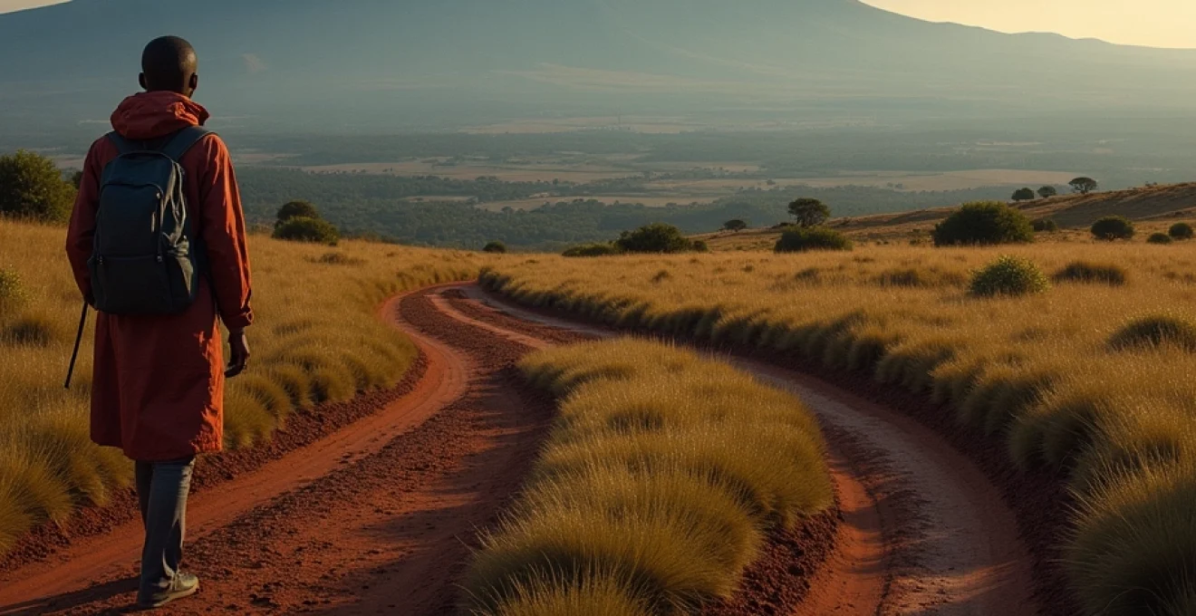
Mount kilimanjaro and the northern circuit: africa’s premier trekking destination
Mount Kilimanjaro dominates the northern Tanzanian landscape as Africa’s highest peak and the world’s tallest free-standing mountain, rising 5,895 metres above sea level. This dormant stratovolcano presents a unique climbing challenge, offering multiple route options that traverse distinct ecological zones from tropical montane forests to arctic alpine conditions. The mountain’s accessibility to non-technical climbers, combined with its extreme altitude demands, creates a compelling adventure that attracts over 50,000 climbers annually.
The northern circuit encompasses not only Kilimanjaro but also the renowned safari destinations of Serengeti, Ngorongoro, Tarangire, and Lake Manyara. This geographical clustering allows visitors to experience dramatic elevation changes, from the crater floor of Ngorongoro at 1,800 metres to Kilimanjaro’s Uhuru Peak, creating opportunities for diverse wildlife encounters and landscape photography within relatively short distances.
Machame route technical specifications and acclimatisation protocols
The Machame Route, known as the “Whiskey Route,” spans approximately 62 kilometres over six to seven days, offering superior acclimatisation profiles compared to shorter alternatives. This route follows the principle of “climb high, sleep low,” with strategic camping elevations that optimise physiological adaptation to reduced oxygen levels. Trekkers ascend through five distinct climate zones, beginning in montane forest ecosystems at 1,640 metres and progressing through moorland, alpine desert, and finally arctic conditions above 5,000 metres.
The route’s technical demands include the challenging Barranco Wall climb at 4,250 metres, requiring basic scrambling skills but no specialized equipment. Success rates on the Machame Route average 85-90% when proper acclimatisation schedules are followed, significantly higher than expedited routes that compress the ascent timeline. The camping infrastructure provides designated sites with basic facilities, though trekkers must be prepared for subfreezing temperatures and potential weather delays above 4,000 metres.
Lemosho route wilderness experience and success rate analysis
The Lemosho Route represents the premium Kilimanjaro experience, offering eight days of trekking across 70 kilometres of diverse terrain with the highest success rates among all route options. Beginning at the remote Londorossi Gate, this route traverses the Shira Plateau’s expansive moorlands, providing exceptional acclimatisation opportunities and reduced crowding compared to popular alternatives. The extended timeline allows for gradual physiological adaptation, with success rates frequently exceeding 95% for properly prepared trekkers.
This route’s wilderness character shines through its initial days crossing the Shira Plateau, where volcanic formations create otherworldly landscapes dotted with endemic plant species like giant groundsels and lobelias. The Lemosho approach joins the Machame Route at Lava Tower, but the additional acclimatisation days significantly improve summit success probability while reducing altitude-related health risks.
Rongai route northern approach and weather pattern advantages
The Rongai Route approaches Kilimanjaro from the northern border with Kenya, offering distinct weather advantages during certain seasons due to the mountain’s rain shadow effect. This route experiences less precipitation than southern approaches, making it particularly attractive during the March-May rainy season when other routes may encounter challenging conditions. The six-day itinerary covers 73 kilometres with a more gradual ascent profile, though it provides fewer acclimatisation opportunities than longer alternatives.
The northern approach showcases different vegetation patterns and wildlife encounters, with greater chances of observing colobus monkeys and diverse bird species in the montane forests. The route’s solitude during most of the year creates a more intimate mountain experience, though the final summit approach via Gilman’s Point can be demanding due to loose scree and steep gradients.
Crater camp technical ascent and High-Altitude camping logistics
Crater Camp represents the ultimate Kilimanjaro challenge, involving overnight camping at 5,790 metres within the mountain’s volcanic crater. This extreme high-altitude camping experience requires advanced mountaineering preparation and exceptional physical conditioning, as the reduced oxygen levels at this elevation present significant physiological stress. Only experienced climbers with proven high-altitude tolerance should attempt this technical variation, which extends standard routes by one to two additional days.
The crater camping experience provides unprecedented access to Kilimanjaro’s inner geological features, including the Northern Icefield, Ash Pit, and Furtwangen Glacier remnants. However, the logistics involve specialized cold-weather camping equipment rated for extreme conditions, as nighttime temperatures frequently drop below -20°C. The technical demands and inherent risks require experienced guides familiar with high-altitude rescue procedures and weather pattern recognition.
Serengeti ecosystem dynamics and the great migration phenomenon
The Serengeti ecosystem represents one of Earth’s most intact and functionally diverse wildlife systems, spanning 30,000 square kilometres across northern Tanzania and southern Kenya. This vast landscape supports over 1.3 million wildebeest, 250,000 zebras, and 500,000 gazelles in their annual migration cycle, creating the planet’s largest terrestrial animal movement. The ecosystem’s functionality depends on complex interactions between rainfall patterns, grass growth cycles, predator-prey relationships, and seasonal resource availability that have evolved over millions of years.
The Serengeti’s ecological significance extends beyond its famous migration, encompassing resident wildlife populations that include over 3,000 lions, 1,000 leopards, and substantial populations of elephants, buffalos, and rhinoceros. The ecosystem’s pristine condition allows researchers to study natural predator-prey dynamics, social behaviours, and evolutionary adaptations in an environment largely unaltered by human intervention. This research foundation has contributed significantly to global understanding of large mammal ecology and conservation strategies.
Wildebeest migration timing and calving season patterns in ndutu
The Great Migration follows predictable seasonal patterns driven by rainfall distribution and grass nutrient content across the Serengeti ecosystem. During December through March, the migration herds concentrate in the Ndutu region and southern Serengeti plains, where short-grass prairies provide optimal grazing for pregnant females. The calving season peaks between January and February, when approximately 8,000 wildebeest calves are born daily during the height of the birthing period.
This calving synchronization represents an evolutionary adaptation that overwhelms predator capacity while ensuring maximum calf survival rates. The nutrient-rich short grasses in the Ndutu area provide essential minerals for lactating mothers, while the open plains facilitate predator detection and escape routes. Research indicates that this timing coordination has remained remarkably consistent over decades, demonstrating the migration’s fundamental dependence on natural rainfall cycles and seasonal resource availability.
Predator-prey relationships during river crossings at mara river
The Mara River crossings represent the migration’s most dramatic and dangerous phase, occurring typically between July and September when herds move northward into Kenya’s Masai Mara. These crossings involve complex decision-making processes among herd leaders, influenced by river flow rates, crocodile populations, and vegetation conditions on both riverbanks. Research has documented that successful crossing sites often feature specific topographical characteristics, including gradual bank approaches and downstream escape routes.
Nile crocodiles in the Mara River have evolved behavioural adaptations specifically for these seasonal crossing events, with some individuals exceeding six metres in length due to abundant seasonal food sources. The predator-prey dynamics during crossings involve not only crocodiles but also lions, leopards, and hyenas that concentrate near crossing points. These interactions create natural selection pressures that influence herd behaviour, individual fitness, and population genetics across the migration species.
Seronera valley Year-Round game viewing and resident wildlife populations
The Seronera Valley functions as the Serengeti’s wildlife hub, supporting substantial resident populations independent of the migration cycles. This region’s year-round water sources and diverse habitat types create optimal conditions for territorial species including lions, leopards, cheetahs, and elephants. The valley’s kopje rock formations provide essential den sites for large cats while offering elevated vantage points for hunting and territorial surveillance.
The resident lion population in Seronera has been extensively studied for over five decades, providing unprecedented insights into pride dynamics, territorial behaviour, and reproductive strategies. These long-term research programmes have documented generational changes in behaviour patterns, genetic diversity, and adaptation to environmental pressures. The concentration of wildlife in this relatively compact area makes Seronera particularly valuable for wildlife photography and behavioral observation throughout the year.
Northern serengeti seasonal movements and kogatende region dynamics
The northern Serengeti, particularly the Kogatende region, experiences dramatic seasonal wildlife fluctuations as migration herds move between Tanzania and Kenya. During the dry season from June through October, this area supports massive concentrations of wildebeest and zebras preparing for or executing river crossings. The landscape’s rolling hills and seasonal streams create complex movement patterns that require intimate local knowledge to predict and locate.
The Kogatende region’s ecosystem dynamics involve intricate relationships between resident and migratory species, with competition for resources intensifying during peak migration periods. Resident wildlife populations, including giraffes, elephants, and various antelope species, must adapt their behaviour patterns to accommodate the massive influx of migratory animals. This seasonal disruption and recovery cycle has shaped the region’s ecological balance over evolutionary timescales.
Ngorongoro conservation area geological formation and biodiversity hotspots
The Ngorongoro Conservation Area encompasses a unique geological phenomenon created by volcanic activity approximately 2.5 million years ago when a massive volcano collapsed, forming the world’s largest intact caldera. This 610-square-kilometre crater floor sits at 1,800 metres elevation, surrounded by rim walls reaching 2,400 metres, creating a natural amphitheatre that supports an extraordinary concentration of wildlife. The caldera’s enclosed nature has fostered the development of a self-contained ecosystem where approximately 25,000 large mammals coexist in remarkable density.
The conservation area’s significance extends beyond the famous crater, encompassing the Oldupai Gorge archaeological sites where some of humanity’s earliest ancestors lived and evolved. The geological diversity includes volcanic highlands, crater lakes, and extensive grasslands that support endemic plant species and create microhabitats for specialized wildlife populations. The area’s designation as both a UNESCO World Heritage Site and Biosphere Reserve recognizes its dual importance for natural conservation and cultural heritage preservation.
The Ngorongoro Crater represents a living laboratory where predator-prey relationships, territorial behaviors, and ecological adaptations can be studied in a naturally contained environment that mirrors conditions from millions of years ago.
The crater’s unique ecology supports one of Africa’s densest lion populations, with territorial ranges significantly smaller than typical savanna environments due to abundant prey availability. The permanent water sources and year-round grazing areas eliminate the need for large-scale migrations, creating stable populations of elephants, buffalos, hippos, and the critically endangered black rhinoceros. The crater floor’s grasslands support over 500 bird species, including both resident and migratory populations that utilize the area’s diverse wetland and grassland habitats.
Research conducted within the crater has contributed significantly to understanding large mammal behaviour, population dynamics, and conservation strategies. The enclosed environment provides natural experimental conditions where scientists can study the effects of habitat size limitations, resource competition, and predator-prey ratios on wildlife populations. These studies have informed conservation practices worldwide, particularly regarding minimum viable population sizes and habitat corridor requirements for large mammal conservation.
Zanzibar stone town UNESCO heritage architecture and swahili cultural synthesis
Zanzibar’s Stone Town represents one of East Africa’s most significant cultural and architectural heritage sites, showcasing over 1,000 years of Swahili civilization development. The historic city centre displays a unique architectural fusion combining Arab, Persian, Indian, and European influences that reflect the island’s position as a central hub in Indian Ocean trade networks. The narrow winding streets, carved wooden doors, ornate balconies, and coral stone buildings create an atmospheric environment that transports visitors through centuries of cultural exchange and commercial activity.
The architectural significance extends beyond aesthetic appeal to encompass innovative building techniques adapted to tropical coastal conditions. Traditional Swahili architecture incorporates sophisticated ventilation systems, elevated foundations for flood protection, and locally sourced materials including coral stone, mangrove timber, and lime mortar. These sustainable building practices evolved over centuries to create structures that remain comfortable and durable in equatorial coastal climates without mechanical cooling or heating systems.
Stone Town’s architectural heritage demonstrates how cultural diversity and commercial prosperity can create lasting urban environments that continue to function effectively centuries after their initial construction.
The cultural synthesis evident in Stone Town’s architecture reflects the broader Swahili cultural tradition that emerged from interactions between African, Arab, Persian, and Indian civilizations. This cultural blending produced unique art forms, musical traditions, culinary practices, and linguistic developments that spread throughout the East African coast. The Swahili language itself serves as a lingua franca across much of East Africa, demonstrating the lasting influence of this cultural synthesis on regional identity and communication.
Modern conservation efforts in Stone Town face complex challenges balancing heritage preservation with contemporary development needs. The UNESCO designation provides international recognition and support for conservation activities, but also requires careful management of tourism impacts and urban development pressures. Successful preservation strategies involve local community engagement, traditional craftsmanship training, and adaptive reuse of historic structures for contemporary functions while maintaining architectural integrity.
Lake tanganyika rift valley system and endemic cichlid fish biodiversity
Lake Tanganyika represents one of Earth’s most extraordinary freshwater environments, containing approximately 16% of the world’s freshwater supply within the Western Rift Valley system. This ancient lake, formed between 9-12 million years ago, reaches maximum depths of 1,470 metres, making it the world’s second deepest lake after Russia’s Lake Baikal. The lake’s extreme age and isolation have fostered remarkable endemic species evolution, with over 95% of its fish species found nowhere else on Earth.
The lake’s cichlid fish populations represent one of the most spectacular examples of adaptive radiation in vertebrate evolution, with over 250 endemic species that have evolved from common ancestors into diverse ecological niches. These evolutionary adaptations include specialized feeding mechanisms, reproductive strategies, and territorial behaviours that demonstrate natural selection processes in real-time. Research on Lake Tanganyika’s cichlids has contributed fundamental insights into evolutionary biology, speciation processes, and adaptive radiation mechanisms.
The lake’s ecosystem extends beyond fish diversity to encompass unique invertebrate communities, endemic gastropods, and specialized bird populations that depend on the lake’s resources. The clear waters and stable temperature profiles create optimal conditions for underwater research and observation, allowing scientists to study complex ecological interactions and behavioural patterns in unprecedented detail. The lake’s multiple endemic species assemblages provide living laboratories for understanding evolution, ecology, and conservation biology in aquatic environments.
Mahale mountains chimpanzee research station and primate behaviour studies
The Mahale Mountains National Park on Lake Tanganyika’s eastern shore hosts one of Africa’s most significant chimpanzee research programmes, with continuous studies spanning over five decades. This remote wilderness area supports approximately 1,000 chimpanzees across multiple communities, providing exceptional opportunities for long-term behavioural research and conservation biology studies. The mountainous terrain and dense tropical forests create challenging research conditions but offer pristine habitats largely unaffected by human disturbance.
Research findings from Mahale have revolutionized understanding of chimpanzee social structures, tool use, cultural transmission, and cognitive abilities. Scientists have documented sophisticated tool-making techniques, complex social hierarchies, and cultural variations between different chimpanzee communities that parallel human cultural diversity. These discoveries have important implications for understanding human evolution, cognitive development, and the origins
of language, social learning, and behavioral complexity in our closest living relatives. The multi-generational data collected at Mahale provides insights into chimpanzee life histories, reproductive success, and environmental adaptations that inform broader conservation strategies for great apes across Africa.
The research station’s infrastructure supports year-round field studies despite the remote location and challenging logistics. Access requires boat transportation across Lake Tanganyika followed by hiking through mountainous terrain, creating natural barriers that help preserve the research environment’s integrity. The long-term commitment required for meaningful primate research has resulted in habituated chimpanzee groups that tolerate human observers, enabling detailed behavioral documentation and individual recognition across multiple generations.
Gombe stream national park jane goodall legacy and ongoing research programs
Gombe Stream National Park represents the birthplace of modern primatology, where Dr. Jane Goodall began her groundbreaking chimpanzee research in 1960. This compact 52-square-kilometre park along Lake Tanganyika’s shore hosts the world’s longest-running study of wild chimpanzees, with continuous research spanning over six decades. The research programme has documented the lives of multiple chimpanzee generations, providing unprecedented insights into individual personalities, family relationships, and cultural transmission patterns.
Goodall’s revolutionary discoveries at Gombe fundamentally changed scientific understanding of what it means to be human. Her observations of tool use, emotional expression, and complex social relationships challenged the prevailing scientific paradigm that separated humans from other animals. The ongoing research continues to reveal new aspects of chimpanzee intelligence, including problem-solving abilities, communication strategies, and adaptive behaviors that demonstrate remarkable cognitive flexibility.
The current research infrastructure at Gombe supports multiple scientific disciplines beyond primatology, including forest ecology, conservation biology, and community engagement studies. The integration of local communities into research and conservation activities has created sustainable models for wildlife protection that balance scientific research with community development needs. The TACARE programme, initiated by the Jane Goodall Institute, demonstrates how community-centered conservation approaches can create positive outcomes for both wildlife protection and human welfare.
Katavi national park remote wilderness and seasonal hippo concentrations
Katavi National Park encompasses 4,471 square kilometres of pristine wilderness in western Tanzania, representing one of Africa’s most remote and least visited protected areas. The park’s isolation has preserved intact ecosystems where large mammal populations exhibit natural behaviors largely uninfluenced by human presence. During the dry season, Katavi hosts spectacular wildlife concentrations around permanent water sources, creating some of Africa’s most dramatic game viewing opportunities.
The park’s seasonal hippo congregations represent one of nature’s most extraordinary spectacles, with over 4,000 hippos concentrating in shrinking pools along the Katuma River. These dense aggregations, sometimes exceeding 200 individuals per pool, create intense social dynamics and territorial competition rarely observed elsewhere. The behavioral interactions during these concentration periods provide valuable insights into hippo social structures, dominance hierarchies, and stress responses under resource-limited conditions.
Katavi’s remote wilderness offers visitors the rare opportunity to experience Africa as it existed centuries ago, where human influence remains minimal and wildlife behavior patterns reflect natural evolutionary adaptations rather than human-modified environments.
The park’s diverse habitats encompass miombo woodlands, seasonal grasslands, and riverine forests that support substantial populations of elephants, buffalos, lions, and leopards. The elephant population, estimated at over 4,000 individuals, demonstrates complex seasonal movement patterns between dry season concentrations around water sources and wet season dispersal across the broader landscape. These movement patterns have remained largely unchanged for decades, indicating the ecosystem’s ecological integrity and the absence of significant human interference.
Research opportunities at Katavi remain largely unexplored due to logistical challenges and limited infrastructure, creating potential for groundbreaking ecological studies in pristine environments. The park’s untouched nature provides baseline conditions for understanding natural ecosystem functioning, predator-prey relationships, and large mammal behavior patterns that can inform conservation strategies across Africa. The combination of accessibility challenges and exceptional wildlife concentrations makes Katavi an ideal destination for serious wildlife enthusiasts seeking authentic wilderness experiences away from traditional tourist circuits.