Seoul’s public transport system stands as one of the world’s most sophisticated and efficient networks, seamlessly connecting every corner of this sprawling metropolis through an intricate web of subways, buses, and integrated payment systems. With over 9.7 million daily passengers utilising the subway system alone, navigating Seoul’s transport infrastructure becomes essential for both residents and visitors seeking to experience the city’s vibrant culture and dynamic lifestyle.
The Korean capital’s transport ecosystem represents a marvel of modern urban planning, combining cutting-edge technology with user-friendly design principles. From the colour-coded subway lines that span across 22 districts to the intelligent bus network featuring real-time tracking capabilities, Seoul has transformed public transportation into an art form. Understanding this system unlocks access to over 700 subway stations and countless bus routes, making every destination within the city remarkably accessible.
What sets Seoul’s public transport apart is its commitment to technological innovation and passenger convenience. The integration of contactless payment systems , multilingual signage, and sophisticated mobile applications creates an environment where language barriers dissolve and navigation becomes intuitive. This comprehensive infrastructure supports millions of journeys daily whilst maintaining punctuality rates exceeding 95%, establishing Seoul as a global benchmark for metropolitan transport excellence.
Seoul metropolitan subway system navigation and line classifications
The Seoul Metropolitan Subway represents the backbone of the city’s transportation network, comprising nine main lines plus additional specialised services that collectively form one of the world’s largest underground rail systems. Each line maintains distinct operational characteristics, passenger demographics, and geographic coverage areas, creating a complex yet highly organised transit matrix that serves over 2.7 billion passengers annually.
Line 1-9 Colour-Coded route mapping and station interchange protocols
Seoul’s subway system employs a sophisticated colour-coding scheme that transforms navigation from a daunting challenge into an intuitive experience. Line 1 operates in dark blue, connecting the northern suburbs through central Seoul to the southern districts, whilst Line 2 forms the city’s circular backbone in bright green. This visual system extends through all nine lines, with each colour representing specific geographic territories and passenger flow patterns.
The interchange protocols between different lines follow standardised procedures designed to minimise transfer times and reduce congestion. Major interchange stations like Gangnam, Sindorim, and Jamsil feature dedicated transfer corridors with clear directional signage in multiple languages. Understanding these transfer pathways becomes crucial during peak hours when passenger volumes can exceed 40,000 people per hour at busy stations.
Station platform layouts maintain consistent design principles across the network, featuring numbered exits that correspond to specific street-level destinations. Each platform displays comprehensive route maps showing all stops, transfer points, and estimated journey times. The systematic approach to station design ensures that passengers can navigate confidently regardless of their familiarity with individual locations.
Sinbundang line and airport railroad express (AREX) integration points
The Sinbundang Line operates as a premium express service connecting Gangnam’s business district to satellite cities in Gyeonggi Province, featuring advanced train technologies that achieve speeds up to 90 kilometres per hour. This line integrates seamlessly with the main subway network at key interchange stations, providing rapid access to Seoul’s southern commercial centres whilst maintaining separate fare structures for express services.
AREX serves as the crucial link between Incheon International Airport and central Seoul, offering both express and all-stop services that cater to different passenger needs. The express service completes the 58-kilometre journey in just 43 minutes, whilst the all-stop service provides economical access to multiple stations along the route. Integration points with the main subway system occur at Seoul Station, Hongik University Station, and Digital Media City, enabling seamless connections to all parts of the metropolitan area.
These specialised lines demonstrate Seoul’s commitment to providing differentiated transport solutions that balance speed, cost, and accessibility. The integration protocols ensure that passengers can transfer between services using single payment cards whilst benefiting from coordinated scheduling that minimises waiting times.
Digital station signage systems and Hangul-English dual language navigation
Seoul’s digital signage infrastructure represents a pinnacle of multilingual accessibility, featuring dynamic LED displays that provide real-time information in Korean, English, Chinese, and Japanese. These systems update continuously to reflect service changes, estimated arrival times, and platform-specific information that enhances passenger decision-making capabilities.
The Hangul-English dual language system extends beyond simple translations to include romanised Korean place names that follow international phonetic standards. This approach ensures consistency across all platforms, maps, and announcements, creating a unified navigation experience that supports international visitors whilst maintaining cultural authenticity. Station names appear in both scripts with clear hierarchical typography that prioritises readability under various lighting conditions.
Interactive digital maps located throughout stations provide touch-screen access to detailed route planning, nearby attractions, and transfer information. These systems connect to central databases that reflect real-time service conditions, enabling passengers to make informed decisions about their journeys. The integration of QR codes allows smartphone users to access additional information and personalised navigation assistance.
Peak hour congestion patterns and express service scheduling
Understanding Seoul’s peak hour dynamics becomes essential for efficient journey planning, as passenger volumes can increase by 300% during morning and evening rush periods. The heaviest congestion occurs between 7:30-9:30 AM and 6:00-8:00 PM, when office workers and students create concentrated demand on specific routes serving business districts and educational institutions.
Express services operate on select lines during peak hours, reducing journey times by up to 25% through strategic station skipping. These services follow predetermined schedules that align with passenger flow patterns, providing additional capacity on heavily utilised routes whilst maintaining regular service frequencies for intermediate stations.
The subway system employs sophisticated crowd management strategies including platform-specific boarding zones, train capacity indicators, and alternative route recommendations during extreme congestion. Real-time passenger density information appears on station displays and mobile applications, enabling travellers to adjust their timing or select alternative routes based on current conditions.
T-money card and wowpass integration systems
Payment technology forms the cornerstone of Seoul’s integrated transport experience, with contactless card systems facilitating seamless travel across multiple transport modes whilst providing significant cost savings through transfer discounts and zone-based pricing. The evolution of these payment platforms reflects Seoul’s position as a global leader in financial technology innovation and urban mobility solutions.
Nfc-enabled payment processing and card registration procedures
Near Field Communication technology powers Seoul’s contactless payment ecosystem, enabling sub-second transaction processing that maintains service efficiency even during peak passenger flows. The NFC infrastructure supports multiple card types including T-money, Cashbee, and international payment cards, creating a flexible payment environment that accommodates diverse user preferences and technological capabilities.
Card registration procedures vary depending on the payment method selected, with T-money cards requiring simple activation at point of purchase whilst Wowpass systems demand passport verification for international users. The registration process unlocks additional features including balance protection, transaction history tracking, and personalised journey recommendations based on usage patterns.
Mobile payment integration through Samsung Pay and other NFC-enabled platforms eliminates the need for physical cards whilst providing enhanced security through biometric authentication. These systems synchronise with transport databases to ensure consistent fare calculation and transfer benefit application across all payment methods.
Distance-based fare calculation algorithm and zone pricing structure
Seoul’s fare calculation system employs sophisticated algorithms that consider journey distance, transport mode, and transfer patterns to determine optimal pricing for each trip. The base subway fare starts at 1,320 Korean Won for journeys up to 10 kilometres, with incremental charges applied for longer distances. This distance-based model ensures fair pricing whilst encouraging efficient route selection and transport mode choices.
Zone pricing structures apply different rates for various service types, with premium services like AREX express trains commanding higher fares that reflect their enhanced speed and comfort levels. The pricing algorithm automatically selects the most economical combination of transport modes for multi-modal journeys, providing passengers with cost-effective travel solutions without requiring manual calculation.
The integrated fare system offers up to 30% savings compared to individual ticket purchases, making regular transport card usage financially advantageous for virtually all passenger categories.
Mobile payment integration through KakaoT and samsung pay transit features
KakaoT represents Seoul’s premier mobile payment platform for transportation services, offering integrated access to subway, bus, and taxi payments through a single application interface. The platform’s transit features include journey planning, real-time vehicle tracking, and automatic payment processing that eliminates the need for physical card interactions.
Samsung Pay’s transit functionality leverages advanced tokenisation technology to secure payment credentials whilst providing instant transaction processing. The system stores multiple payment methods and transport cards digitally, enabling users to switch between different accounts or card types based on specific journey requirements or promotional offerings.
These mobile solutions include sophisticated features such as spending analytics, journey history, and integration with broader Seoul city services including parking payments and municipal facility access. The platforms update automatically to reflect fare changes, service modifications, and new route additions, ensuring users always have access to current information.
Card balance management via convenience store Top-Up networks
Seoul’s extensive convenience store network provides universal access to card balance management, with over 25,000 locations offering top-up services through standardised payment terminals. Major chains including 7-Eleven, CU, and GS25 maintain consistent service protocols that enable quick balance additions using cash, credit cards, or mobile payments.
Automated top-up features allow users to establish minimum balance thresholds that trigger automatic recharging when funds become depleted. This functionality prevents service interruptions whilst providing budget management tools that track spending patterns and suggest optimal balance levels based on individual usage habits.
The convenience store integration extends beyond simple balance management to include card replacement services, transaction history printing, and access to promotional offers exclusive to transport card users. This comprehensive approach transforms routine balance management into opportunities for enhanced service engagement and customer value creation.
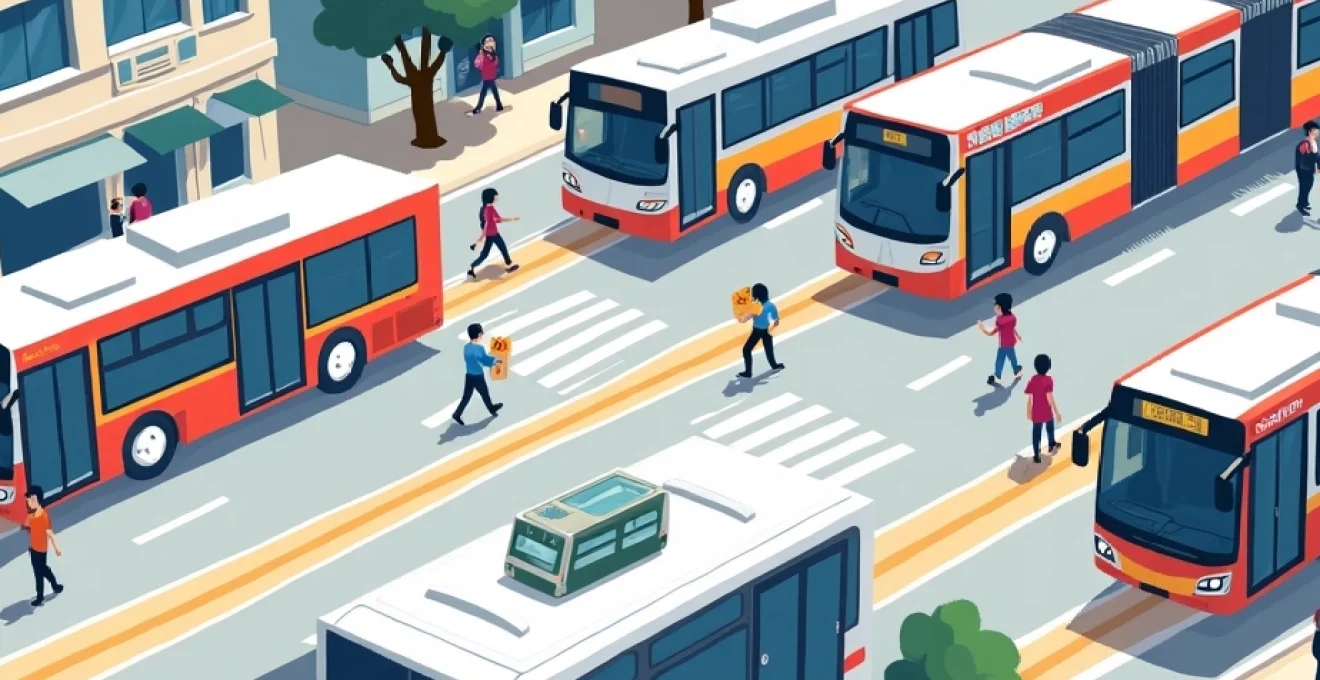
Seoul bus network classifications and route identification
Seoul’s bus network operates through a sophisticated classification system that categorises services based on route characteristics, passenger demographics, and geographic coverage areas. The colour-coded bus system includes blue trunk routes for long-distance travel, green branch routes for local connectivity, yellow circular routes serving central business districts, and red express routes connecting Seoul with surrounding metropolitan areas. This systematic approach enables passengers to identify appropriate services quickly whilst ensuring optimal resource allocation across the network.
Route identification follows standardised numbering conventions that reflect service type and operational characteristics. Trunk routes utilise three-digit numbers beginning with specific prefixes, whilst branch routes employ four-digit codes that indicate their relationship to main arterial services. The numbering system incorporates geographic references that help passengers understand route coverage areas and connection possibilities with other transport modes.
Modern bus stops feature sophisticated information systems displaying real-time arrival data, route maps, and transfer connections through digital LED displays. These systems connect to central traffic management networks that monitor vehicle locations, passenger loads, and service reliability metrics. The integration of GPS tracking technology provides arrival predictions with accuracy rates exceeding 90%, enabling passengers to optimise their waiting times and journey planning decisions.
Night bus services designated with ‘N’ prefixes operate extended hours to accommodate Seoul’s vibrant nightlife and shift-work patterns. These services follow modified routes that prioritise major transport hubs and residential areas, maintaining essential connectivity during overnight hours when subway services cease operations. The night network serves approximately 180,000 passengers nightly across 34 dedicated routes that complement the standard daytime service pattern.
Bus payment systems integrate seamlessly with subway fare structures, providing automatic transfer discounts when passengers switch between transport modes within specified time windows. The discount mechanism recognises journey patterns and applies optimal pricing based on the complete multi-modal trip rather than individual service segments. This integration encourages public transport usage whilst ensuring revenue sustainability across all service providers.
Accessibility features throughout the bus network include low-floor vehicles, wheelchair accommodation spaces, and audio-visual announcement systems that support passengers with mobility or sensory impairments. These features comply with international accessibility standards whilst reflecting Seoul’s commitment to inclusive public transport services. Dedicated spaces and priority seating arrangements ensure comfortable travel for elderly passengers, pregnant women, and families with young children.
Gangnam district transit hubs and major transfer stations
Gangnam District serves as Seoul’s premier business and commercial centre, anchored by sophisticated transit infrastructure that facilitates over 1.2 million daily passenger movements through strategically positioned interchange hubs. These facilities represent architectural and operational masterpieces that seamlessly integrate multiple transport modes whilst supporting the district’s role as Korea’s economic powerhouse and cultural epicentre.
Gangnam Station itself functions as the district’s primary transit nexus, connecting subway Lines 2 and Shinbundang through a vast underground complex that extends across multiple city blocks. The station’s design incorporates extensive retail facilities, dining options, and cultural spaces that transform transit waiting time into opportunities for shopping, entertainment, and social interaction. Daily passenger volumes exceed 200,000 people, making efficient crowd management and intuitive wayfinding essential operational priorities.
The Coex Convention and Exhibition Centre area benefits from dedicated transport connections through Bongeunsa Station and Samsung Station, both of which provide direct access to major hotel districts and international business facilities. These stations feature enhanced services including multilingual assistance, luggage storage facilities, and premium waiting areas designed specifically for international business travellers and conference attendees.
Gangnam’s transit hubs process more international passenger traffic than many national airports, requiring specialised services and infrastructure to support global business activities.
Express bus connections link Gangnam directly to Incheon International Airport through dedicated highway routes that bypass central Seoul congestion. These services operate at 15-minute intervals during business hours, providing guaranteed travel times that enable precise scheduling for international flights and business meetings. The integration of real-time traffic data ensures service reliability even during adverse weather conditions or unexpected traffic situations.
Underground pedestrian networks connect major transit stations with office buildings, shopping centres, and residential complexes throughout Gangnam District. These climate-controlled walkways enable comfortable year-round travel regardless of weather conditions whilst reducing street-level congestion and vehicle emissions. The networks include moving walkways, escalators, and elevator systems that accommodate heavy pedestrian flows and accessibility requirements.
Smart city technologies deployed throughout Gangnam’s transit infrastructure include predictive maintenance systems that monitor equipment performance, passenger flow sensors that optimise service frequencies, and environmental monitoring that maintains optimal air quality and temperature conditions. These technologies contribute to service reliability rates exceeding 99.5% whilst supporting sustainability objectives through energy-efficient operations and reduced environmental impact.
Real-time transit applications and digital journey planning tools
Seoul’s digital transit ecosystem encompasses sophisticated mobile applications and web-based platforms that transform journey planning from reactive navigation into proactive travel optimisation. These tools leverage real-time data streams from across the transport network to provide accurate, personalised recommendations that consider individual preferences, accessibility requirements, and current service conditions.
Citymapper Seoul has emerged as the premier third-party navigation solution, offering comprehensive multi-modal journey planning that integrates subway, bus, taxi, and walking routes into unified travel recommendations. The application’s algorithms consider factors including transfer walking distances, service frequencies, accessibility requirements, and even weather conditions to suggest optimal travel solutions. Real-time service alerts and alternative route suggestions ensure passengers can adapt quickly to unexpected disruptions or delays.
The official Seoul Subway application provides authoritative information directly from transport operators, including precise arrival times, service announcements, and detailed station information. This platform offers offline map access for underground areas with limited connectivity whilst maintaining synchronisation with central systems when network access becomes available. The application supports journey sharing features that enable coordinated travel planning for groups and families.
KakaoMap integration extends beyond simple navigation to include social features that allow users to share journey experiences, report service conditions, and access crowd-sourced information about station facilities and local attractions. The platform’s machine learning capabilities analyse individual usage patterns to provide increasingly personalised recommendations that reflect user preferences for speed, comfort, cost, or scenic routes.
| Application | Key Features | Offline Capability | Multi-Modal Integration |
|---|---|---|---|
| Seoul Subway Official | Real-time arrivals, service alerts, station maps | Limited offline maps | Subway and bus connections |
| Citymapper Seoul | Journey optimisation, weather integration, live tracking | Cached routes only | All transport modes plus walking |
| KakaoMap Transit | Social features, crowd-sourced data, business integration | Basic map access | Complete transport ecosystem |
Augmented reality features available through select applications overlay directional information onto camera views, providing intuitive navigation assistance within complex station environments. These features prove particularly valuable for international visitors who may struggle with Korean language
signage and directional indicators. Machine learning algorithms continuously improve recommendation accuracy by analysing successful journey patterns and passenger feedback to refine future suggestions.Emergency notification systems integrate across all digital platforms to provide immediate alerts about service disruptions, security incidents, or severe weather conditions. These systems utilise push notifications, in-app banners, and SMS messaging to ensure critical information reaches passengers regardless of their current application usage patterns. The coordinated approach to emergency communication helps maintain passenger safety whilst enabling rapid response to changing operational conditions.
Voice-activated journey planning features support hands-free navigation through integration with popular virtual assistants including Google Assistant and Samsung Bixby. These capabilities prove particularly valuable for passengers with visual impairments or those carrying luggage who cannot easily interact with touchscreen interfaces. The voice recognition systems understand multiple languages and dialects, ensuring accessibility for Seoul’s diverse international community.
Data synchronisation across platforms ensures consistent information regardless of which application passengers choose to use for journey planning. This unified approach eliminates confusion from conflicting arrival times or route recommendations whilst enabling passengers to switch between applications based on specific feature requirements without losing continuity in their travel experience.
Advanced analytics within these applications provide personalised travel insights including carbon footprint calculations, cost savings from public transport usage versus private vehicle alternatives, and health benefits from walking connections between stations. These features support Seoul’s broader sustainability objectives whilst encouraging continued public transport adoption through quantifiable personal benefits.
Crowdsourcing capabilities enable passengers to contribute real-time observations about service conditions, accessibility issues, or facility problems directly through their chosen navigation applications. This community-driven approach to information gathering enhances service quality monitoring whilst creating a collaborative environment where passengers actively participate in transit system improvements.
Integration with Seoul’s broader smart city infrastructure allows transit applications to access information from traffic management systems, air quality monitoring networks, and municipal event calendars. This comprehensive data integration enables sophisticated journey planning that considers factors beyond simple transport logistics, including outdoor air quality for walking segments and potential congestion from special events or construction activities.
Seoul’s digital transit applications process over 15 million journey requests daily, generating valuable data insights that continuously improve service planning and passenger experience optimisation.
Offline functionality across major applications ensures basic navigation capabilities remain available even when underground or in areas with poor cellular coverage. These systems cache essential route information, station maps, and transfer details locally whilst maintaining the ability to provide directional guidance without requiring continuous internet connectivity. Automatic synchronisation occurs when network access resumes, updating cached information with current service conditions.
The evolution of Seoul’s public transport system represents more than mere technological advancement; it embodies a comprehensive vision for urban mobility that prioritises passenger experience, environmental sustainability, and economic efficiency. Through innovative payment systems, sophisticated routing algorithms, and user-centric design principles, Seoul has created a transport ecosystem that serves as a global model for metropolitan mobility solutions.
Whether navigating the extensive subway network, utilising the comprehensive bus system, or seamlessly transferring between multiple transport modes, passengers benefit from decades of careful planning and continuous technological refinement. The integration of digital tools with physical infrastructure creates an environment where public transport becomes not just functional necessity but an enhanced urban experience that connects millions of people to opportunities, culture, and community throughout Korea’s dynamic capital city.
Understanding and utilising Seoul’s public transport system opens doors to authentic city experiences whilst demonstrating the potential for technology-enhanced urban mobility to improve quality of life for residents and visitors alike. The system’s success reflects Seoul’s commitment to innovation, accessibility, and sustainable urban development that continues to evolve in response to changing passenger needs and emerging technological capabilities.